• LIFESTYLE

  • TIPS N TRICK

  • NEWS

Showing posts with label traveler indonesia. Show all posts

Sunday, November 6, 2016

Destinasi wisata indonesia, yang mirip dengan luar negeri

keindahan alam Indonesia memang sudah tidak diragukan lagi. Mulai dari Sabang sampai Merauke, alam Indonesia pasti akan selalu membuat takjub siapapun yang melihatnya. Bahkan di beberapa daerah memiliki pemandangan yang serupa dengan beberapa tempat wisata terkenal di luar negeri.
1. Cukang Taneuh Ciamis dan Grand Canyon Colorado

Terletak di daerah Cukang Taneuh, Ciamis, Jawa Barat terdapat satu destinasi wisata yang sangat mirip dengan Grand Canyon, Colorado, USA  yaitu deretan ngarai eksotis berhias stalaktit dan stalagmit yang telah berusia jutaan tahun. Saking miripnya dengan Grand Canyon yang ada di Colorado maka orang-orang kini menjuluki Cukang Taneuh sebagai Green Canyon. Di sini kamu bisa menikmati alam hijau nan teduh sambil menyusuri Green Canyon di atas perahu.

2.Sungai Maron dan Sungai Amazon

Ingin menjelajahi hutan sungai Amazon yang terkenal itu? Kamu tidak perlu jauh-jauh terbang ke Amerika karena di daerah Pacitan, Jawa Timur terdapat satu tempat wisata yang sangat mirip dengan sungai Amazon. Tempat wisata tersebut bernama Sungai Maron yang terletak di Desa Maron Kecamatan Donorojo. Kamu bisa menyusuri sungai Maron dengan naik perahu dan kamu bisa menikmati sensasi sungai Amazon ala Indonesia.
3. Gurun Sahara ala Yogyakarta
Gumug Pasir Parangkusumo mirip dengan gurun Sahara (c) jogja.co & travelingthere
Di Yogyakarta ada satu tempat dimana kamu bisa menikmati pemandangan gurun pasir seperti di gurun Sahara. Tepatnya di Gumug Pasir Parangkusumo, hamparan gundukan pasir ini benar-benar menyerupai gurun pasir sungguhan. Kamu juga bisa menikmati sand boarding, sky yang dilakukan di atas hamparan pasir.
4. Raja Ampat dan Phi Phi Island
Raja Ampat yang Mirip Phi Phi Island (c) randyandanstkipsurya & cdn.phuket-tour-top-agent.com
Siapa yang tidak mengenal keindahan alam Raja Ampat, Papua. Jajaran pulau yang masih asri dan panorama laut yang luar biasa indah pasti membuat siapa saja kagum. Pemandangan serupa juga bisa ditemukan di Thailand tepatnya di Phi Phi Island. Namun, bagi siapa saja yang pernah mengunjungi kedua tempat ini pasti setuju jika Raja Ampat jauh lebih indah dibandingkan dengan Phi Phi Island.
5. Jembatan Soge Pacitan dan Sydney Harbour Bridge
Jembatan Soge Pacitan Ala Sydney Harbour Bridge (c) jualtanah & habourrocks.com
Ingin ber-selfie ria dengan latar Sydney Harbour Bridge? Tidak perlu jauh-jauh pergi ke negeri kangguru karena di kecamatan Ngadirojo, Pacitan, berdiri sebuah jembatan penghubung yang eksotis bernama jembatan Soge. Jembatan ini sekilas memiliki desain arsitektur yang mirip dengan Sydney Harbour Bridge, jadi anggap saja ketika kamu ber-selfie ria di jembatan Soge berarti kamu telah berdiri di Sydney Harbour Bridge-nya Indonesia.
6. Patung Megalitikum Lore Rindu dan Patung Batu Pulau Paskah
Patung Megalitikum Lore Lindu, Sulawesi Tengah yang Mirip Dengan Patung Batu Pulau Paskah (c) tynypic
Selain keindahan alam, Indonesia juga kaya akan peninggalan sejarahnya. Di daerah Taman Nasional Lore Rindu Sulawesi Selatan kamu bisa menemui peninggalan sejarah berupa kumpulan 431 situs megalitikum yang jika dilihat mengingatkan kita akan patung-patung sama yang ada di pulau Paskah.  Umur patung-patung batu ini juga tidak kalah menabjubkan karena diperkirakan berasal dari 1300 SM, wow!
7. Monumen Simpang Lima Kediri dan Arc De Triomphe Paris
Monumen Simpang Lima Gumul, Kediri Mirip Arc de Triomphe, Paris (c) bosmobil & shedexpedition
Jika Anda berkesempatan mengunjungi kota Kediri, pastikan Anda mengunjungi Arc De Triomphe-nya Kediri atau yang lebih dikenal sebagai Monumen Simpang Lima Gumul. Bangunan ini terinpirasi dari kisah Jongko Joyoboyo yang bercita-cita ingin menyatukan lima wilayah di Kerajaan Kediri. Di dinding monumen ini juga terpahat cerita-cerita tentang sejarah kota Kediri.
8. Candi Sukuh dan Piramida Maya Chichen Itza
inca
Jika dilihat sekilas, kedua bangunan ini memiliki struktur yang sama. Ya, Candi Sukuh yang berada di Desa Berjo, Karanganyar, Jawa Tengah ini sangat mirip dengan Piramida Maya Chichen Itza. Bahkan para peneliti pun sampai sekarang masih meneliti kenapa kedua bangunan yang terpisah oleh dua benua ini memiliki kemiripan desain arsitekturnya.
9. Patung Budha Mojokerto dan Patung Budha Tidur Wat Pho Thailand
Patung Buddha di Mojokerto Mirip Dengan Patung Buddha Tidur di Wat Pho, Thailand (c) actasurya & richard-seaman
Bagi Anda yang pernah pergi ke Thailand dan mengunjungi patung Budha tidur di Wat Pho pasti akan tidak menyangka bahwa ternyata di Indonesia terdapat patung yang sejenis. Patung Budha tidur ini terletak di Mojokerto dan merupakan patung Budha tidur terbesar ketiga setelah Thailand dan Nepal.
10. Laguna Maladewa ala Pantai Ora
Pantai Ora dan Maladewa (c) ajak-jalan & telegraph
Pulau Maladewa dianggap sebagai salah satu tempat terbaik dan terfavorit untuk menghabiskan waktu liburan karena pantai di Maladewa memiliki laguna yang sangat indah. Sayangnya, untuk berlibur di tempat ini dibutuhkan budget yang tidak sedikit. Nah, jika kamu ingin merasakan laguna Maladewa ala Indonesia datanglah ke Pantai Ora, Maluku. Pantai ini juga memiliki laguna dengan pemandangan bawah air yang jernih sebening kaca.

Friday, September 16, 2016

BUNAKEN DIVING SPOT

BUNAKEN

Image result for bunaken island
Bunaken is an island of 8 km², part of the Bunaken National Marine Park. Bunaken is located at the northern tip of the island of SulawesiIndonesia. It belongs administratively to the municipality of ManadoScuba diving attracts many visitors to the island.
The waters of Bunaken National Marine Park are up to 1,566 m deep in Manado Bay, with temperatures ranging between 27 and 29 °C. It has a high diversity of - corals, fish, echinoderms or sponges. Notably, 7 of the 8 species of giant clams that occur in the world, occur in Bunaken. It also claims to have seven times more genera of coral than Hawaii,[1] and has more than 70% of all the known fish species of the Indo-Western Pacific.[2]Bunaken National Park extends over an area of 890.65 km² of which only 3% is terrestrial, including Bunaken Island, as well as the islands of Manado Tua, Mantehage, Nain and Siladen.
Image result for bunaken island
Oceanic currents may explain, in part, why Bunaken National Marine Park has such a high level of biodiversity. Northeasternly currents generally sweep through the park but abundant counter currents and gyros related to lunar cycles are believed to be a trap for free swimming larvae. This is particularly true on the south side of the crescent-shaped Bunaken Island, lying in the heart of the park. A snorkeler or diver in the vicinity of Lekuan or Fukui may spot over 33 species of butterfly fish and numerous types ofgroupers, damsels, wrasses and gobies. The gobies, smallish fish with bulging eyes and modified fins that allow them to attach to hard surfaces, are the most diverse but least known group of fish in the park.
Image result for bunaken

Image result for bunaken island

CLICK FOR VIDEO

RAJA AMPAT ISLAND

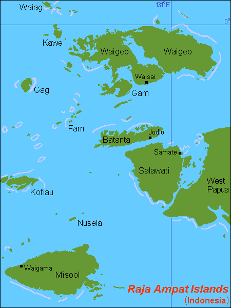
Located off the northwest tip of Bird's Head Peninsula on the island of New Guinea, in Indonesia's West Papua provinceRaja Ampat, or the Four Kings, is an archipelago comprising over 1,500 small islands, cays, and shoals surrounding the four main islands of MisoolSalawatiBatanta, and Waigeo, and the smaller island of Kofiau. The Raja Ampat archipelago is the part of Coral Trianglewhich contains the richest marine biodiversity on earth.
Raja Ampat Regency is a new regency which separated from Sorong Regency in 2004.[1] The population of the Regency was recently (January 2014) put at 49, 048. It encompasses more than 40,000 km² of land and sea, which also contains Cenderawasih Bay, the largest marine national park in Indonesia. It is a part of the newly named West Papua province of Indonesia which was formerly Irian Jaya. Some of the islands are the most northern pieces of land in the Australian continent.
Raja Ampat is considered the global epicenter of tropical marine bio-diversity and is referred to as The Crown Jewel of the Bird's Head Seascape, which also includes Cenderawasih Bay and Triton Bay.
Raja Ampat Islands
Karta ID RajaAmpat Isl.PNG
Map of the islands

Raja Ampat Islands
Geography
ArchipelagoRaja Ampat Islands
Total islands612
Major islandsMisool
Salawati
Batanta
Waigeo
Area40,000 km2 (15,000 sq mi)(land area = 8,034 km2)
Administration
Demographics
Population49,048 (2014)

History[edit]

The name of Raja Ampat comes from local mythology that tells about a woman who finds seven eggs. Four of the seven eggs hatch and become kings that occupy four of Raja Ampat biggest islands whilst the other three become a ghost, a woman, and a stone.
History shows that Raja Ampat was once a part of Sultanate of Tidore, an influential kingdom from Maluku. Yet, after the Dutch invaded Maluku, it was shortly claimed by the Netherlands.
The first recorded sighting and landing by Europeans of the Ampat Islands was in the person of the Portuguese navigator Jorge de Menezes and his crew in 1526, on route from Biak, the Bird's Head Peninsula, and Waigeo, to Halmahera (Ternate).
The English explorer William Dampier gave his name to Dampier Strait, which separates Batanta island from Waigeo island. To the east, there is a strait that separates Batanta from Salawati. In 1759 Captain William Wilson sailing in the East Indiaman Pitt navigated these waters and named one strait Pitt strait, after his vessel; this was probably the channel between Batanta and Salawati.

Population[edit]

The main occupation for people around this area is fishing since the area is dominated by the sea. They live in a small colony of tribes that spreads around the area. Although traditional culture still strongly exists, they are very welcoming to visitors. Raja Ampat people are more like Ambonese than Papuan people and now some of them are Muslim and some of them are Christian.[2]

Geography[edit]

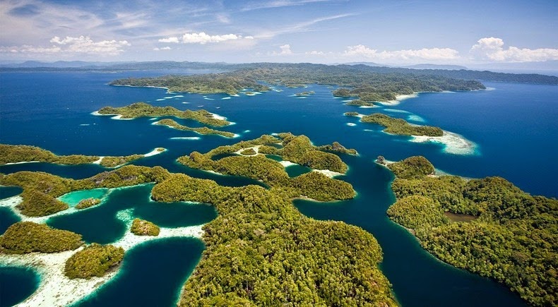
Image result for raja ampat islands
According to Conservation International, marine surveys suggest that the marine life diversity in the Raja Ampat area is the highest recorded on Earth.[3] Diversity is considerably greater than any other area sampled in the Coral Triangle composed of Indonesia, Malaysia, Philippines, Papua New Guinea, Solomon Islands, and East Timor. The Coral Triangle is the heart of the world's coral reef biodiversity, making Raja Ampat quite possibly the richest coral reef ecosystems in the world.The oceanic natural resources around Raja Ampat give it significant potential as a tourist area. Many sources place Raja Ampat as one of their top ten most popular places for diving whilst it retains the number one ranking in terms of underwater biodiversity.
Image result for raja ampat islands
The area's massive coral colonies along with relatively high sea surface temperatures, also suggest that its reefs may be relatively resistant to threats like coral bleaching and coral disease, which now jeopardize the survival of other coral ecosystems around the world. The Raja Ampat islands are remote and relatively undisturbed by humans.
The high marine diversity in Raja Ampat is strongly influenced by its position between the Indian and Pacific Oceans, as coral and fish larvae are more easily shared between the two oceans. Raja Ampat's coral diversity, resilience, and role as a source for larval dispersal make it a global priority for marine protection.
Image result for raja ampat islands
1,508 fish species, 537 coral species (a remarkable 96% of all scleractinia recorded from Indonesia are likely to occur in these islands and 75% of all species that exist in the world[4]), and 699 mollusk species, the variety of marine life is staggering.[5] Some areas boast enormous schools of fish and regular sightings of sharks, such as wobbegongs.
Raja Ampat Islands have at least three ponds containt unpoisoned jellyfish, all in Misool area.[6]
Although accessing the islands is not that difficult, it takes some time. It takes six hours flight from Jakarta, the capital city of Indonesia to Sorong. Then, taking a boat to reach the islands is necessary.
Image result for raja ampat islands

Documentary film[edit]

The documentary film Edies Paradies 3 (by Otto C. Honegger) has been broadcast by the biggest Switzerland television broadcaster, Schweizer Fernsehen. The film tells about Raja Ampat's natural underwater beauty which is likened to Switzerland's only inhabited area of the region of around 50,000 residents and is considered like the "Amazon" because of the underwater world located in the heart of the world's Coral Triangle.[7]

KOMODO NATIONAL PARK

The Komodo National Park is a national park in Indonesia located within the Lesser Sunda Islands in the border region between the provinces of East Nusa Tenggara and West Nusa Tenggara. The park includes the three larger islands Komodo,Padar and Rinca, and 26 smaller ones,[1] with a total area of 1,733 km2 (603 km2 of it land). The national park was founded in 1980 to protect the Komodo dragon, the world's largest lizard.[3] Later it was dedicated to protecting other species, including marine species. In 1991 the national park was declared a UNESCO World Heritage Site.[4]
Komodo National Park has been selected as one of the New7Wonders of Nature.[5] The waters surrounding Komodo island also contains rich marine biodiversity. Komodo islands is also a part of the Coral Triangle, which contains one of the richest marine biodiversity on earth.
Komodo National Park
IUCN category II (national park)
Komodo dragon at Komodo National Park.jpg
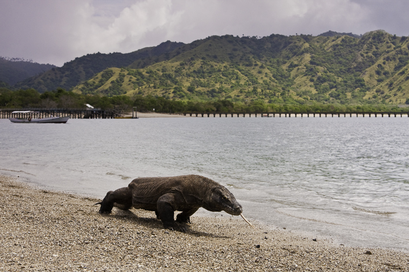
Komodo dragon at Komodo National Park
Map showing the location of Komodo National Park
Komodo NP
LocationLesser Sunda Islands,Indonesia
Coordinates8°32′36″S 119°29′22″ECoordinates8°32′36″S 119°29′22″E
Area1,733 km2,[1] 2,193.22 km2[2]
Established1980
Visitors45,000 (in 2010)
Governing bodyMinistry of Forestry
TypeNatural
Criteriavii, x
Designated1991 (15th session)
Reference no.609
State PartyIndonesia
RegionAsia-Pacific

History[edit]

Komodo National Park was established in 1980 and was declared a World Heritage Site and a Man and Biosphere Reserve byUNESCO in 1991. The park was initially established to conserve the unique Komodo dragon (Varanus komodoensis), first discovered by the scientific world in 1912 by J.K.H. Van Steyn. Since then conservation goals have expanded to protecting its entire biodiversity, both marine and terrestrial.
The majority of the people in and around the park are fishermen originally from Bima (Sumbawa), Manggarai, South Flores, andSouth Sulawesi. Those from South Sulawesi are from the Suku Bajau or Bugis ethnic groups. The Suku Bajau were originally nomadic and moved from location to location in the region of SulawesiNusa Tenggara and Maluku, to make their livelihoods. Descendants of the original people of Komodo, the Ata Modo, still live in Komodo, but there are no pure blood people left and their culture and language is slowly being integrated with the recent migrants.
Little is known of the early history of the Komodo islanders. They were subjects of the Sultanate of Bima, although the island’s remoteness from Bima meant its affairs were probably little troubled by the Sultanate other than by occasional demand for tribute.

Geography and clim

The park comprises a coastal section of western Flores, the three larger islands of KomodoPadar and Rinca, 26 smaller islands and the surrounding waters of the Sape Straights. The islands of the national park are of volcanic origin. The terrain is generally rugged, characterized by rounded hills,[3] with altitudes up to 735 m.[1] The climate is one of the driest of Indonesia with annual rainfall between 800mm and 1000mm. Mean daily temperatures in the dry season from May to October are around 40 °C.[3]Image result for KOMODO NATIONAL PARK

Image result for KOMODO NATIONAL PARK

Flora and fauna[edit]

Image result for KOMODO NATIONAL PARK
The hot and dry climate of the park, characterized by savannah vegetation, makes it to a good habitat for the endemic Komodo dragon(Varanus komodoensis).[1] Their populations are restricted to the islands of Komodo (1,700), Rinca (1,300), Gili Motang (100), Gili Dasami (100), and Flores (c. 2,000),[6] while extinct on Padar.[3]
Cloud forests appear only in few areas above 500 metres but they provide habitat to several endemic flora. Coastal vegetation includesmangrove forest, which generally appear in the sheltered bays of the three larger islands.[3]
Fringing and patch coral reefs are extensive and best developed on the north-east coast of Komodo.[3] The park is rich in marine life, including whale sharksocean sunfishmanta rayseagle rayspygmy seahorsefalse pipefishclown frogfishnudibranchsblue-ringed octopusspongestunicates, and coral.
Varieties of cetaceans inhabit in adjacent waters from smaller sized dolphins to sperm whales[7] and even blue whales.[8][9] Omura's whales, one of the least known of rorquals have been confirmed to range waters within the park.[10] Endangered dugongs still live in Komodo areas as well.
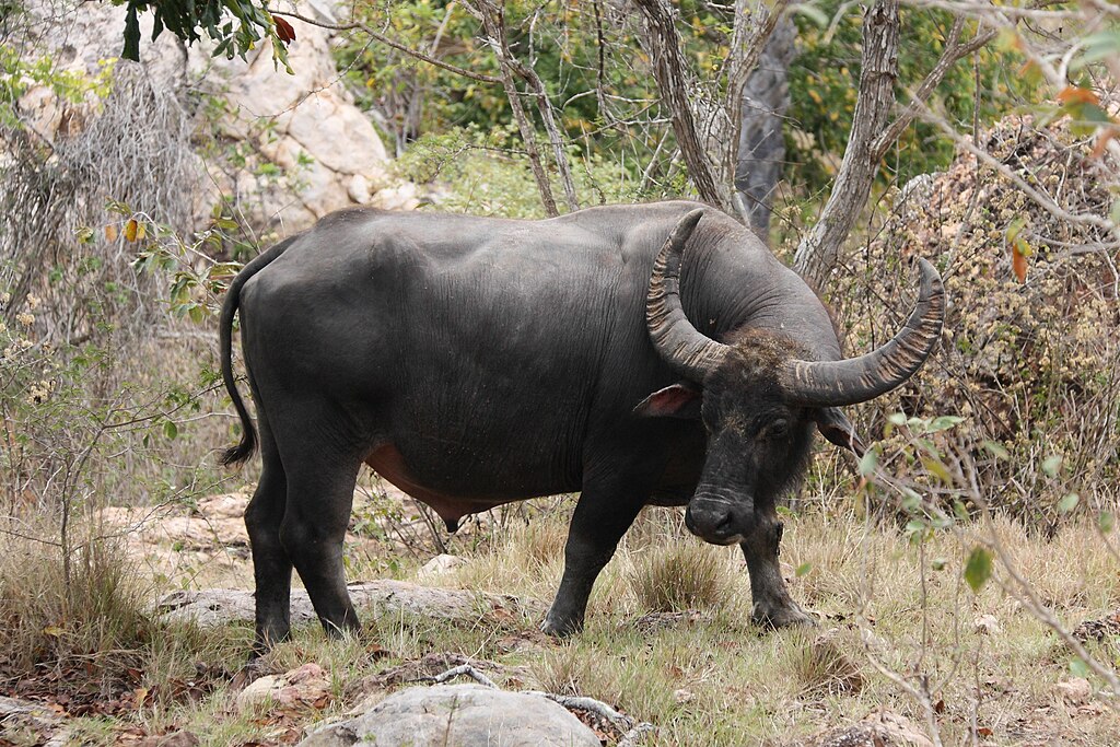
The terrestrial fauna is of rather poor diversity in comparison to the marine fauna. The number of terrestrial animal species found in the park is not high, but the area is important from a conservation perspective as some species are endemic. Many of the mammals are Asiatic in origin Including the Timor deer, wild boar, water buffalo, crab eating macaques and civet. Several of the reptiles and birds are Australian in origin. These include theorange-footed scrubfowl, the lesser sulpher crested cockatoo, and the helmeted friarbird.
The most famous of Komodo National Park's reptiles is the Komodo dragon (Varanus komodoensis). It is the world's largest lizard and is among the world's largest reptiles and can reach 3m or more in length and weigh over 70 kg.[11]
Twelve terrestrial snake species are found on the island in addition to marine species. Snakes include the Javan spitting cobra (Naja sputatrix), Russell’s viper (Daboia russelii),white-lipped pit viper (Trimeresurus albolabris), blue lipped sea krait (Laticauda laticaudata), and Timor python (Python timoriensis). Lizards include nine skink species (Scinidae), geckos (Gekkonidae), limbless lizards (Dibamidae), and the monitor lizards such as the Komodo dragon (Varanidae). Frogs include the Asian bullfrog (Kaloula baleata), the endemic Komodo cross frog (Oreophryne jeffersoniana) and Oreophryne darewskyi. Frogs are typically found at higher, moister altitudes. The saltwater crocodile (Crocodylus porosus) was once present within the park in coastal areas including mangrove swamps but is extinct within the area.
Mammals found within the park include the Timor rusa deer (Cervus timorensis), the main prey of the Komodo dragon, horses (Equus sp.), water buffalo (Bubalus bubalis), wild boar (Sus scrofa vittatus), crab-eating macaque (Macaca fascicularis), Asian palm civet (Paradoxurus hermaphroditus lehmanni), the endemic Rinca rat (Rattus rintjanus), and fruit bats. Domestic mammals on within the park include goats, cats and dogs which are feral.
One of the main bird species is the orange-footed scrubfowl (Megapodius reinwardti), a ground dwelling bird. In areas of savanna, 27 species were observed. The zebra dove(Geopelia striata) and spotted dove (Spilopelia chinensis) were the most common species. In mixed tropical deciduous habitat, 28 bird species were observed, and helmeted friarbird (Philemon buceroides), green imperial pigeon (Ducula aenea), and lemon-bellied white-eye (Zosterops chloris) were the most common. Other birds include vibrantly coloured species such as green junglefowl (Gallus varius), great-billed parrot (Tanygnathus megalorynchos), and the critically endangered lesser sulpher crested cockatoo(Cacatua sulphurea). Two eagle species are found in the park, the white-bellied sea eagle and the extremely rare Flores hawk-eagle which is present on Rinca and Flores and reported but unconfirmed on Komodo Island.

Conservation[edit]

The island of Padar and part of Rinca were established as nature reserves in 1938. Komodo Island was declared a nature reserve in 1965, and in January 1977 as a biosphere reserve under the UNESCO Man and Biosphere Programme.[4] The three islands were declared a national park in 1980, which was later extended to include the surrounding marine area and a section of Flores in 1984.[3] In 1991 the national park was declared a UNESCO World Heritage Site.
Since 1995, the national park authority has been supported by The Nature Conservancy (TNC), an American environmental organization. A new management plan was co-authored with TNC and implemented in 2000 to address the problem of increasing resource exploitation, both marine and terrestrial. Most pressure on marine resourcesoriginates from fishing communities and commercial enterprises from outside the park. However, regulations and restrictions on resource use impact mostly on park residents, who have few options to make a living but rely on what the park has to offer. The provision of alternative livelihoods is part of the overall management strategy, but communities within the park are yet to benefit from appropriate measures addressing their needs.[12]
After 5 years operation, in 2010 Putri Naga Komodo's (PNK) permit was yanked. PNK was a nonprofit joint venture company partially funded by the TNC and the World Bank to operate tourist facilities in hopes of eventually making the park financially self-sustaining. After the moment more illegal fishermen came due to enforcement declined greatly following the exit of TNC that helped fight destructive fishing practices. In early 2012, dive operators and conservationists found many desolate coral sites, reminiscent of grey moonscapes. Illegal fishermen are blasting sites with 'bombs' in a process known as blast fishing. The fisherman use fertilizer and kerosene mixed in beer bottles as explosives or use squeeze bottles to squirt cyanide into the coral to stun and capture fish. In the past two years more than 60 illegal fishermen have been arrested and even one of the suspects was shot and killed after the fishermen tried to escape by throwing fish bombs at the rangers.[13]

Human habitation[edit]

Image result for VILLAGE AT KOMODO NATIONAL PARK
Education[edit]There are presently almost 4,000 inhabitants living within the park spread out over four settlements (Komodo, Rinca, Kerora, and Papagaran). All villages existed prior to 1980 before the area was declared a national park. In 1928 there were only 30 people living in Komodo Village, and approximately 250 people on Rinca Island in 1930. The population increased rapidly, and by 1999, there were 281 families numbering 1,169 people on Komodo, meaning that the local population had increased exponentially. Komodo Village has had the highest population increase of the villages within the park, mostly due to migration by people from Sape, Manggarai, Madura, and South Sulawesi. The number of buildings in Kampung Komodo has increased rapidly from 30 houses in 1958, to 194 houses in 1994, and 270 houses in 2000. Papagaran village is similar in size, with 258 families totaling 1,078 people. At the 2010 Census, Komodo village had 1,508 inhabitants and Papagaran village had 1,262 inhabitants. As of 1999, Rinca’s population was 835, and Kerora's population was 185 people. The total population currently living in the park is 3,267 people, while 16,816 people live in the area immediately surrounding the park.
The average level of education in the villages of Komodo National Park is grade four of elementary school. There is an elementary school located in each of the villages, but new students are not recruited each year. On average, each village has four classes and four teachers. Most of the children from the small islands in the Kecamatan Komodo (Komodo, Rinca, Kerora, Papagaran, Mesa) do not finish elementary school. Less than 10% of those who do graduate from elementary school continue to high school since the major economic opportunity (fishing) does not require further education. Children must be sent to Labuan Bajo to attend high school, but this is rarely done in fishermen’s families.

Health[edit]

Most of the villages located in and around the park have few fresh water facilities available, if any, particularly during the dry season. Water quality declines during this time period and many people become ill. Malaria and diarrhea are rampant in the area. On Mesa island, with a population of around 1,500 people, there is no fresh water available. Fresh water is brought by boat in jerrycans from Labuan Bajo. Each family needs an average of Rp 100,000.- per month to buy fresh water (2000). Almost every village has a local medical facility with staff, and at least a paramedic. The quality of medical care facilities is low.

Socio-cultural and anthropologic conditions[edit]

Traditional Customs: Traditional communities in Komodo, Flores and Sumbawa have been subjected to outside influences and the influence of traditional customs is dwindling. Television, radio, and increased mobility have all played a part in accelerating the rate of change. There has been a steady influx of migrants into the area. At the moment nearly all villages consist of more than one ethnic group.

Religion[edit]

The majority of fishermen living in the villages in the vicinity of the park are Muslims. Hajis have a strong influence in the dynamics of community development. Fishermen hailing from South Sulawesi (Bajau, Bugis) and Bima are mostly Muslims. The community from Manggarai are mostly Christians.

Anthropology and language[edit]

There are several cultural sites within the park, particularly on Komodo Island. These sites are not well documented, however, and there are many questions concerning the history of human inhabitance on the island. Outside the park, in Warloka village on Flores, there is a Chinese trading post remnant of some interest. Archeological finds from this site have been looted in the recent past. Most communities in and around the park can speak Indonesian. Bajo language is the language used for daily communication in most communities.

Conflicts between conservationists and local community[edit]

Controversy surrounds the death of several fishermen since the 1980s. The circumstances of the fishermen’s deaths are contested. While park patrols (including, at the time, police and navy personnel) claim they acted in self-defense, fishing communities accuse park management of having deliberately killed the fishermen.[14]
In late February 2014, Brimob Special Police shot dead two poachers, when they opened fire with their homemade firearms. The poachers attempted to hunt deer in the park which fall prey to Komodo dragons.[15]

Tourism[edit]

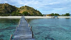
Kanawa Island, a touristic island in the Komodo National Park.
Scuba diving is popular because of the park's high marine biodiversity.[16] The development of, largely marine-based, ecotourism is the main strategy to make the park self-financing and generate sufficient revenue through entrance fees and tourism licenses to cover operational and managerial costs. To this end, a joint venture between TNC and a tourism operator were granted a tourism concession, that also entails extensive park management rights.[17] This concession has generated an ongoing controversy. The joint venture has been accused of making decisions behind closed doors, and many people in and around Komodo claim that they haven’t been consulted regarding decisions that ultimately affect their lives.[18]
Komodo Island and Rinca were once part of Flores and they are separated from the large Island of Sumbawa to the West by the Sape Strait. The ocean in the Strait drops hundreds of meters. The Pacific Ocean to the north and the Indian ocean to the south are actually at different heights – so the flow of currents from the Pacific to the Indian during tidal exchanges makes the currents among the strongest in the world. In the (relatively) shallow waters along the east coast of Komodo towards Labaun Bajo, these currents can be extremely dangerous with inexperienced guides.[19]
The number of visitors to the park increased from 36,000 in 2009 to 45,000 in 2010. Most of the visitors were foreign tourists as the high transport cost to this remote location is less affordable for local visitors. The park can accommodate up to 60,000 visitors a year according to the local tourism agency.[20]
Several types of boat tours run through the national park including upscale scuba liveaboards, short daily snorkel trips and 4 day, 3 night 'tourist boats' between Lombok and Flores. The tourist boats run very frequently, but have uncertain safety records. In an August 2014 incident one of these tourist boats sank, and 2 tourists were lost. Strong currents and waves separated the stranded passengers and crew who were floating a sea in lifevests.[21]Image result for KOMODO NATIONAL PARK
Image result for KOMODO NATIONAL PARK